The HALO Group has considerable expertise and experience in using a wide variety of remote sensing data for Earth systems characterisation. While the focus of our work is often on terrestrial hydrological systems, we have undertaken a range of activities that explore applications in oceanic, atmospheric and even arctic applications. Following is a brief overview of this work, with links to ongoing projects that team members are engaged in. Further details can be found within the page links and also under the Research tab.
- Remote sensing of evapotranspiration: Prof McCabe has more than 10 years of experience in the estimation of land surface heat fluxes from satellite systems. Together with a number of his team and with international collaborators, he has explored multi-scale retrieval of evapotranspiration from multiple satellite sensors, intercomparison projects to evaluate satellite predictions, as well as current activities with international space agencies (ESA) and programs (GDAP) to develop regional and global scale flux estimates.
Further information on this work can be found here.
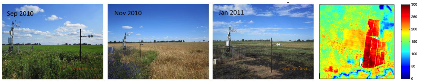
Multi-scale/multi-temporal analysis of land surface heat fluxes over an agricultural site in Australia. See Ershadi et al. (2013) for details.
- Microwave based remote sensing of soil moisture: Prof McCabe has been actively engaged in the remote sensing of soil moisture since 2003, publishing a number of papers examining the retrieval accuracy of the (then) recently launched AMSR-E sensor (see A, B, C). Recently, we have been working with Prof Richard de Jeu from the Vrije University in Amsterdam to develop a long-time series of harmonized soil moisture retrievals using a range of
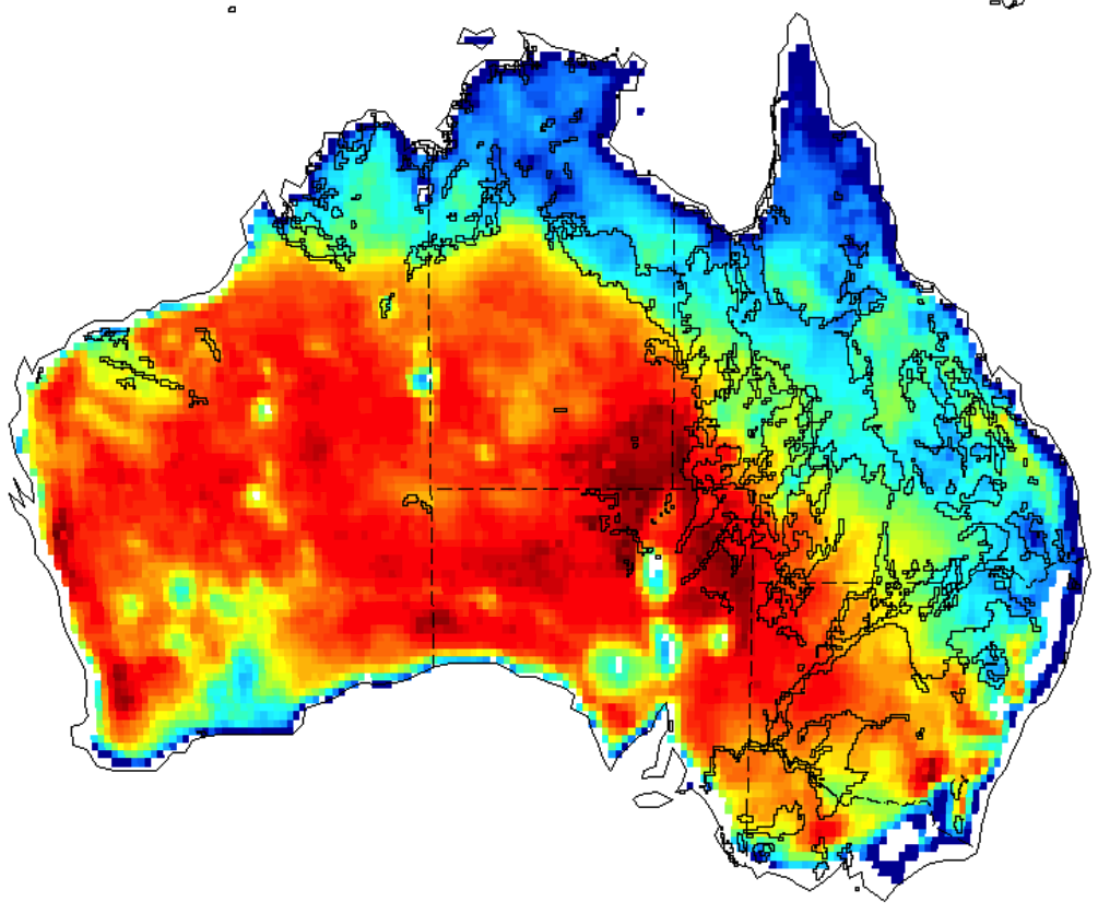 passive (and active) microwave sensors. These data provide great insights into hydrological behaviour and dynamics and offer improved understanding into a range of linked processes (land-atmosphere interactions, droughts, heat-waves etc).
Further information on this work can be found here.
- Remote sensing of vegetation optical depth: In addition to using microwave based systems to interpret soil moisture dynamics at the near surface (see above), one of the most interesting variables that can be derived from such sensors is information on the aboveground living biomass, which is retrieved through a property that is termed the vegetation optical depth (VOD). The VOD acts as an indicator of the water content of both woody and leaf components and is distinct from optical vegetation remote sensing data such as the normalized difference vegetation index in that it is: (a) less prone to saturation in dense canopies; (b) sensitive to both photosynthetic and non-photosynthetic biomass; and (c) less affected by atmospheric conditions. As such, it provides a great deal of information on vegetation dynamics, phenology and change, particularly with the capacity to develop long-term data sets.
Further information on this work can be found here.
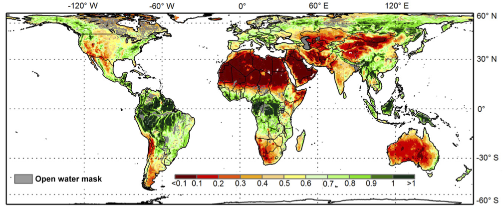
Annual average vegetation optical depth (VOD) for 1988-2008. Regionas likely to be affected by open water are masked grey.
- Remote sensing of vegetation (reflectance/NIR): The reflected satellite signal in the visible to shortwave infrared region has great utility for detecting vegetation dynamics and physiological condition at a range of spatial and temporal scales, highly advantageous for agricultural monitoring and management activities. However advances in the utilization and interpretation of available satellite sensor data is still needed to realize the full potential. The HALO group is involved in activities to advance the use of multispectral, superspectral and hyperspectral remote sensing data for retrieving vegetation characteristics. We are also engaged in studies on their relationship to plant functional traits, validation against in-situ measurements and integration into land surface models.
Further information on this work can be found here.
Apart from these particular research themes, the HALO Group is active in a wide variety of development and application of remote sensing data, from characterising land cover and land use changes, mapping and monitoring land surface features and structures (DEMs) to exploring features in the linked oceanic and atmospheric domains.