Remote sensing has great potential for estimating leaf and canopy biophysical properties essential for tracking changes in plant health, phenology, nutrient availability, water content, and photosynthetic function, which in turn impacts water, energy and carbon exchange processes in the terrestrial biosphere. However, developing versatile retrieval methodologies is challenging due to limitations in the radiometric information content and confounding influences from the atmosphere, canopy and soil. The HALO group is involved in activities to advance the use of multispectral, superspectral and hyperspectral remote sensing data for retrieving vegetation characteristics. We are also engaged in studies on their relationship to plant functional traits, validation against in-situ measurements and integration into land surface models as further detailed below:
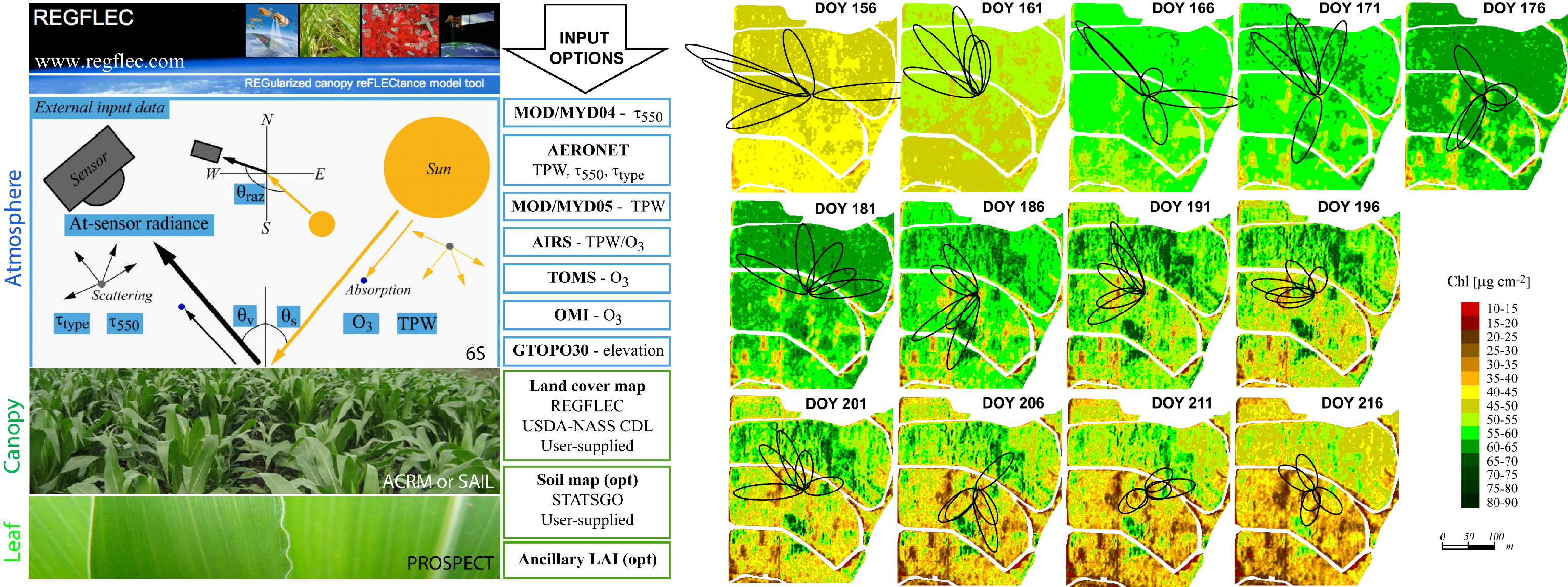
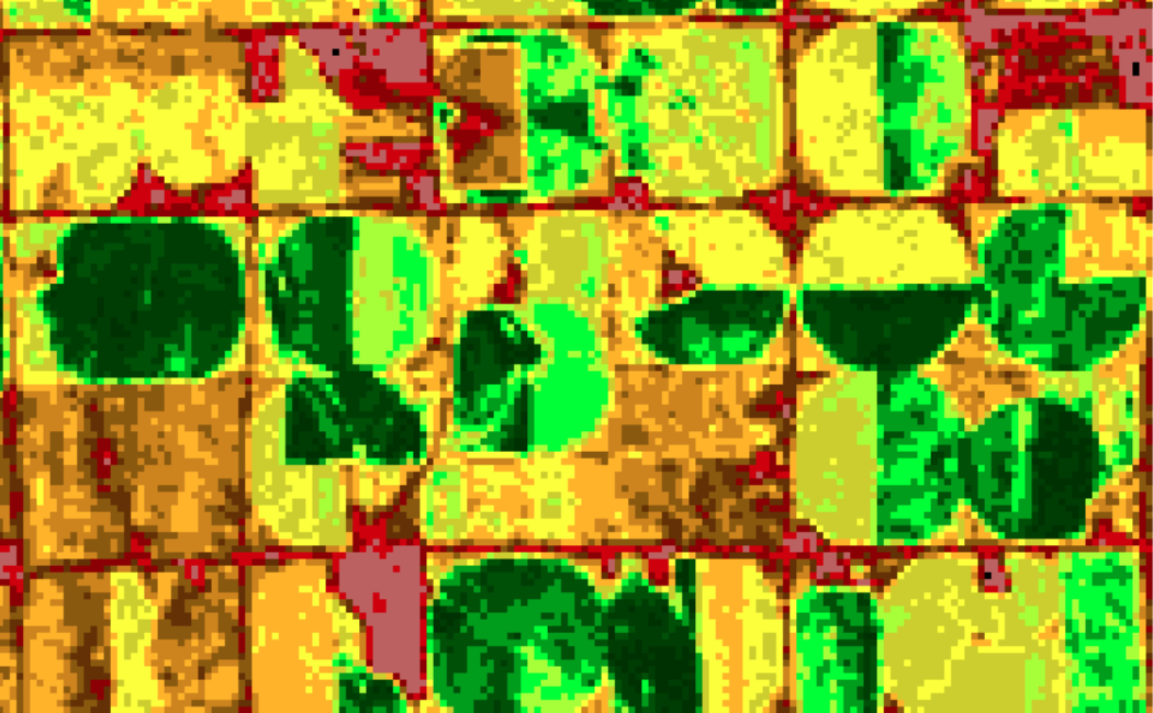
- Canopy reflectance modelling: The reflected satellite signal in the visible to shortwave infrared region of the electromagnetic spectrum can be translated into key biophysical and biochemical properties, such as leaf area index (LAI) and leaf chlorophyll content (Chl), from the inversion of canopy reflectance models. However novel regularization strategies are needed to increase robustness and accuracy of retrieved properties and more reliably separate soil, leaf and canopy variables. Dr. Houborg has developed an integrated regularized radiative transfer modelling framework ( REGFLEC) for automated processing and intelligent utilization of at-sensor radiance observations from various satellite systems (e.g. SPOT, Landsat, Hyperion) directly for joint retrieval of leaf area index and leaf chlorophyll content ( Houbor g et al., 2013). The automated REGFLEC retrieval system facilitates time-series mapping of LAI and Chl thereby providing critical information on vegetation density and phenology, the vitality of vegetation and photosynthetic functioning at fine spatial scales. Work is in progress to extend the applicability to other sensor systems (e.g. RapidE ye, Sentinel-2) and perform time-series vegetation mapping and analyses over targeted agricultural sites within the Kingdom of Saudi Arabia

Diagram of REGFLEC Field-wide time-series maps of REGFLEC derived leaf chlorophyll content
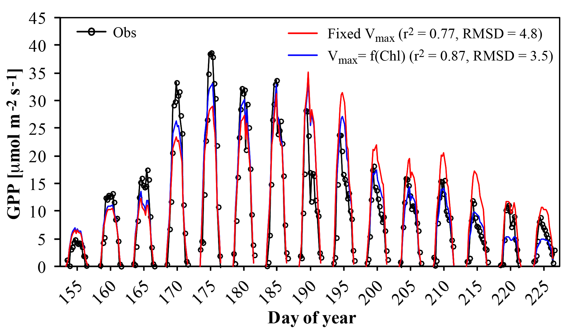
- Integration into land surface models: Leaf chlorophyll (Chl) may serve as an additional and potentially important variable for land-surface remote sensing because of its close relationship to leaf Nitrogen ( Evans, 1989) and thus leaf photosynthetic activity. Recent results by Dr. Houborg ( Houborg et al., 2013) support the use of Chl as a proxy for photosynthetic capacity (Vcmax) using generalized relationships between Vcmax and Chl, and advocate the potential of satellite retrieved Chl for constraining land surface model simulations of carbon and water fluxes in space and time. Dr. Houborg is also collaborating with scientists at the USDA-ARS Hydrology and Remote Sensing Lab on using REGFLEC-based Chl retrievals to parameterize light-use-efficiency within a thermal-based carbon, water and energy exchange model. Further details on this work can be found in Houborg et al. (2011), which highlights the potential synergy between thermal infrared and shortwave reflective wavebands in producing valuable remote sensing data for joint estimation of carbon, water and heat fluxes within a two-source energy balance framework. This modelling framework is also part of a larger effort aimed towards the implementation of a near real-time remote sensing based agricultural monitoring system for the MENA region as described here.

Impact of satellite-based Chl constraint on land surface model (CLM4) simulations of gross primary productivity


