The HALO group is engaged in the development and application of land surface modelling systems for the Middle East and North Africa (MENA) region. Key activities involve the implementation of an integrated multi-scale satellite-based water, carbon and energy exchange model for near real-time agricultural monitoring purposes and the establisment of an in-house capability to run a system of state of the art land surface models as further detailed below:
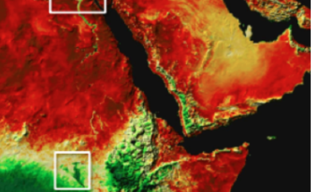
- Satellite-based Modelling Systems: Enhanced satellite-based monitoring systems are particularly needed for the MENA region due to limited fresh water resources, an often inefficient use of these, and relatively poor in-situ monitoring as a result of sparse meteorological observations. The ESOM Group, in close collaboration with scientists at the USDA-ARS Hydrology and Remote Sensing Lab, is implementing an integrated modelling approach for near real-time monitoring of land surface fluxes from continental down to sub-field scales. This approach is based on synergistic application of multiple sensors and wavebands in the visible to shortwave infrared (VSWIR) and thermal infrared (TIR) domain. The system consists of the Atmosphere-Land Exchange Inverse (ALEXI) model and associated flux disaggregation scheme (DisALEXI), the REGularized canopy reFLECtance (REGFLEC) model and the Spatial and Temporal Adaptive Reflectance Fusion Model (STARFM), which in conjunction with model reanalysis data and multi-sensor data from polar orbiting (Landsat and MODIS) and geostationary (GOES, MSG) satellite platforms facilitates daily mapping of field-scale water, carbon and energy fluxes. A unique attribute of this scalable modelling system is the use of TIR data as a proxy for sub-surface moisture status, obviating the need for precipitation input, in combination with REGFLEC-derived leaf area index and leaf chlorophyll content that function as valuable descriptors of crop development and health, nutrient availability and photosynthetic function.
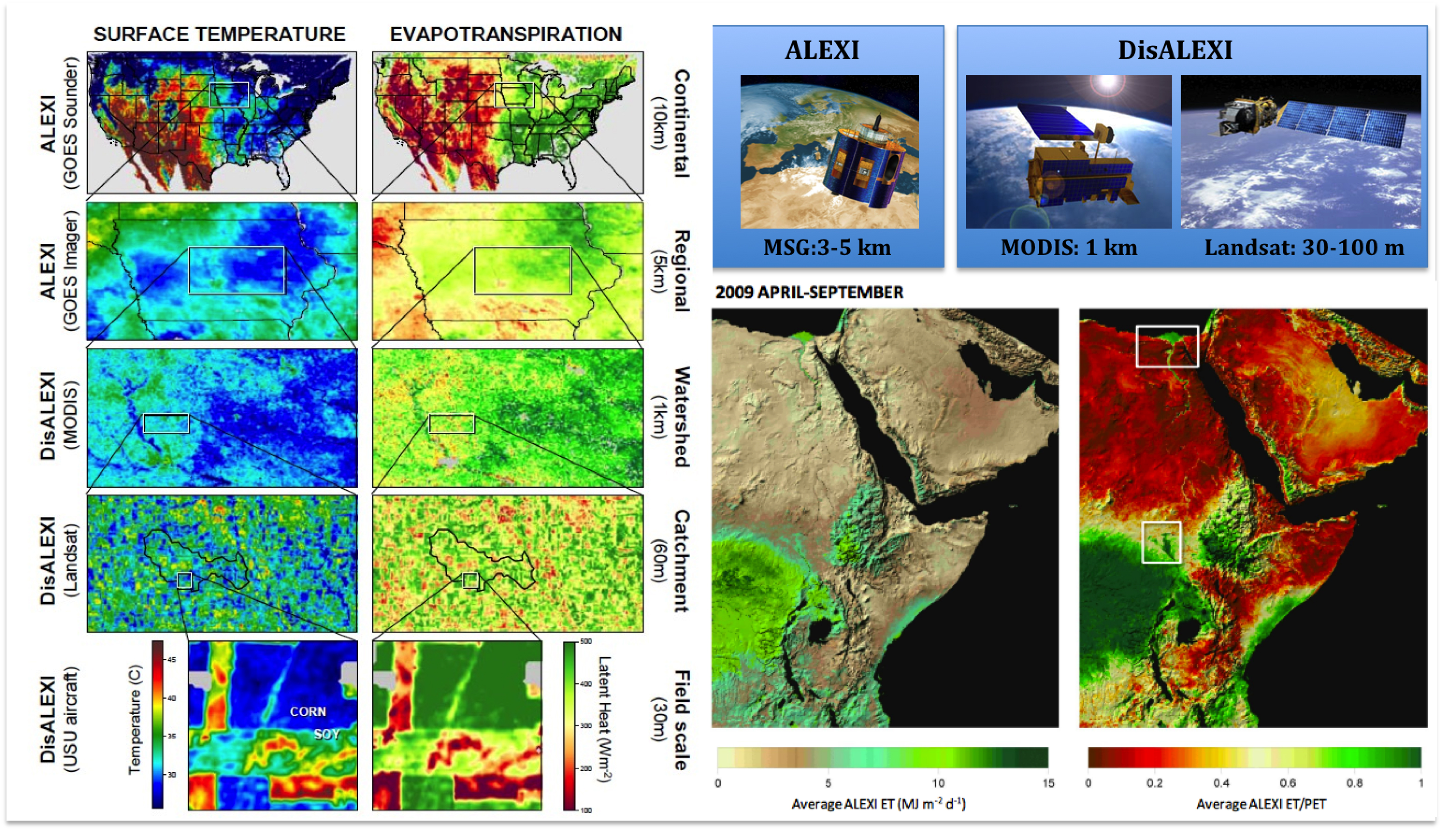
Scalable flux mapping based on a combination of geostationary and polar orbiting satellites
- System of Land Surface Models: State of the art process-based land surface models (CLM4 and CABLE) are currently being ported to the KAUST supercomputing system to run over the region. While these models include comprehensive descriptions of biogeophysical and biogeochemical processes for studying integrated hydrologic and carbon cycle processes in a realistic manner, they remain extremely difficult to parameterize over spatial and temporal domains. Satellite data have great potential for informing these modelling systems and a key objective is to move towards the integration of multiple satellite products simultaneously using a relevant data assimilation framework. Recent work by Dr. Houborg in collaboration with scientists in the Hydrological Sciences at NASA Goddard Space Flight Center (Houborg et al., 2012), demonstrated improved hydrological modeling skill by the assimilation of Terrestrial Water Storage (TWS) from the Gravity Recovery and Climate Experiment ( GRACE) twin satellites over the continental USA, and the ESOM group will be looking into the potential value of GRACE observations in association with other satellite products for constraining and reducing uncertainties of model predicted land surface states and fluxes over the MENA region.
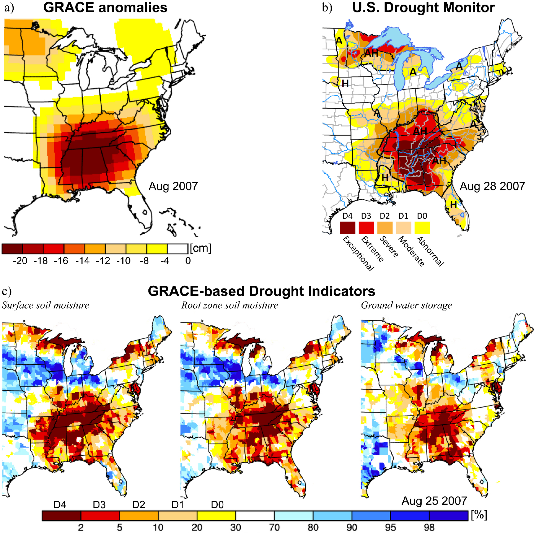
Correspondence between (a) the GRACE monthly water storage anomaly fields, (b) the U.S. Drought Monitor product, and (c) drought indicators based on model-assimilated GRACE TWS observations during the drought in the southeastern United States in August 2007