Understanding the characteristics of water and energy cycle behaviour in semi-arid to hyper-arid zones is a considerable challenge for hydrological scientists, not the least because it is in these locations that data is often the hardest to come by. Our research encompasses a range of topics, from describing the surface and sub-surface hydrology of these environments to modeling the flow of water and energy and undertaking in-situ observations to better constrain the uncertainty.
While we are in the process of establishing a hydrological observatory to undertake detailed water and energy cycle measurements in these systems, we are pursuing a range of complimentary projects aimed at furthering our understanding of arid zone hydrology. Some of these ongoing projects are described below:
- Flood Modelling and Risk Assessment: In order to develop management plans for estimating the flood risk that occurring frequently over the western regions of Saudi Arabia, the HALO group is currently working on quantifying the hydrological components (precipitation, surface runoff, evapotranspiration, and transmission loss) coupled within an appropriate hydrological modeling system. Such a model is also crucial for forecasting of flood events and the HALO group are exploiting available digital data sets acquired from satellite based remote sensing, together with output from weather forecasting models to provide the information necessary to develop an accurate and precise hydrological modelling system. The NASA Shuttle Radar Topographic Mission (SRTM) 90 m resolution is being used to build an accurate Digital Elevation Model (DEM) of the region for watersheds delineation and geomorphological parameters estimation. The precipitation amount, intensity and spatial pattern will be retrieved from the satellite based Tropical Rainfall Measuring Mission (TRMM). Coupling these data within an approprite modelling framework will enable an assessment of flood risk: an atypical but critically important arid zone hydrological process.
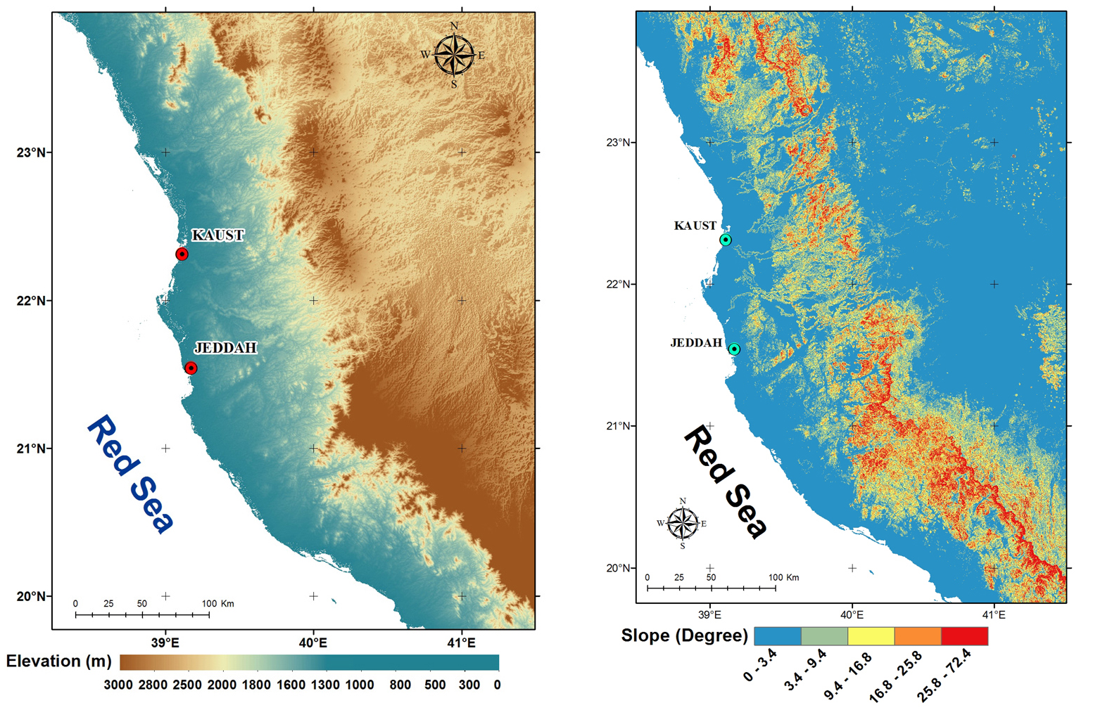
Digital Elevation Model (DEM) and slope map for the Jeddah region and surroundings
- Paleo-hydrology through Geochemical Analysis: To develop a comprehensive interpretation of the surface and sub-surface hydrology of the Middle East and North Africa (MENA) region, an understanding of the paleohydrology and paleoclimatic regimes is required. To derive such information, the HALO Group will be undertaking field sampling campaigns of the exisiting shallow and deep aquifers throughout the MENA and performing a range of geochemical analyses on the collected groundwater samples. These analyses will include: 1) cation and anion concentrations; 2) stable isotopic compositions of hydrogen and oxygen in water and carbon in dissolved inorganic
 carbon (DIC); 3) 14C abundance in DIC for model age estimation; 4) dissolved noble gas concentrations for estimation of recharge temperature; and 5) tritium (3H) measurements. Using the information developed from this geochemical analysis will provide considerable insight into the longer term patterns and drivers of these hydrological systems and aid in further understanding the implications of more modern beheaviour and response
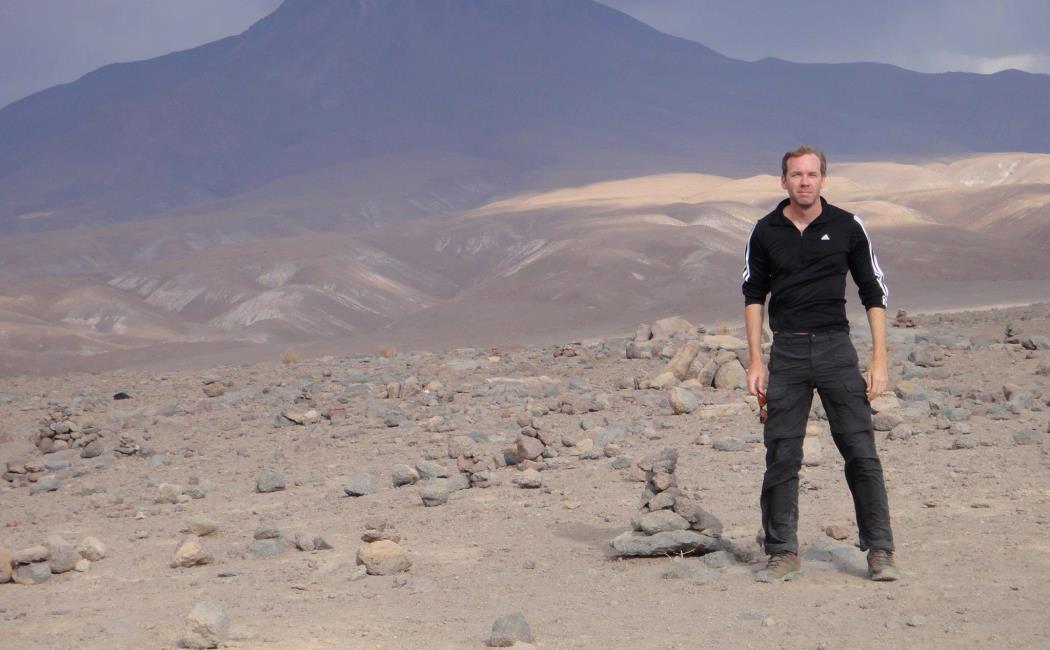
Dr Abouelmagd undertaking groundwater sampling for noble gas analysis, Sinai Desert, July 2010
- Characterising Water and Energy Fluxes using Lysimeters: in collaboration with Prof Tom Missimer and Dr Khan Jadoon, we are in the process of installing three UMS Meteo-Lysimeter systems at locations near and within the KAUST campus in an effort to better understand a range of processes related to arid systems. One aspect of interest is exploring the heat exchanges occuring between the surface and sub-surface, especially in describing the energy budget at the surface. Using these instruments, together with additional above-ground sensor systems (GPR, thermal infrared camera, multi-spectral systems) we will be undertaking a range of synthetic experiments that seek to characterise a range of hydrological responses. Together with colleagues in the Numerical Porous Media Center (NUMPOR) we will also be simulating these systems for mass and heat transfer, to provide a more
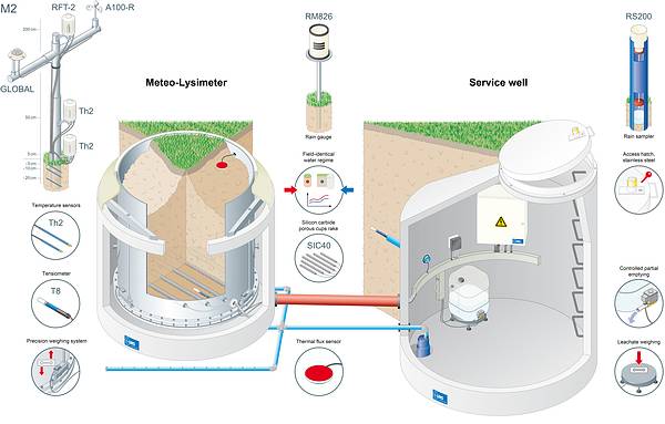 fundamental knowledge of arid zone behaviour. We will also be working with colleagues in the Centre for Desert Agriculture at KAUST to explore the plant biophysical responses of selected species to a range of stress factors (including salinity, drought and heat stress).
UMS Lysimeter System (see link)